Rankin County, Mississippi
What is GIS?
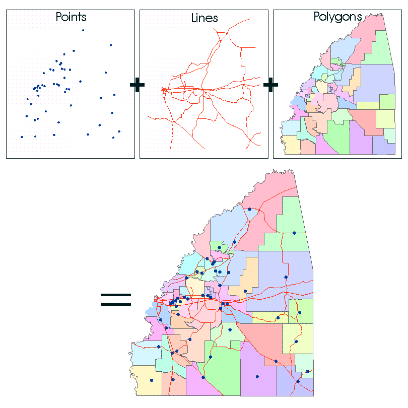
In the strictest sense, a GIS is a computer system capable of assembling, storing, manipulating and displaying geographically referenced information, such as data identified according to their locations. Unlike a paper map, where "what you see is what you get," a GIS map can combine many layers of information to produce specialized maps.
Services

Contact Us
- Phone: (601) 825-1470
- Fax: (601) 824-2457
- Staff Directory
Topics of Interest
More Information
Contact Us
211 E. Government St
Brandon MS 39042
![]() Site Design and Content Copyright © {Current Year} Rankin County, MS
Site Design and Content Copyright © {Current Year} Rankin County, MS
Site Design and Content Management by CORE Business Technologies